Aquifer Delineation
Project Description
Improved aquifer boundaries for shallow and buried aquifers must be delineated in the state to enhance aquifer management and protection abilities. Existing geology maps, cross sections, test hole and well data, and aerial photography, often times in conjunction with drilling, well installation, water-level measurement, and water sampling, will be used to delineate aquifer boundaries at a scale of 1:100,000. The aquifer boundaries will be incorporated into a GIS so they can be integrated with other environmental data sets.
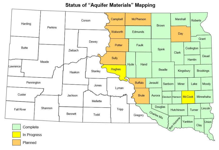
Although the overall goal of this effort is to accomplish what is described in the paragraph above, a short-term need has been recognized for production of maps depicting the depth from land surface to the first mappable aquifer material. Therefore, a new map series titled Aquifer Materials Map is being produced for counties in the glaciated region of South Dakota.
What does an Aquifer Materials Map show?
It shows areas that are underlain by aquifer material. The aquifer materials are categorized by depth intervals consistent with the state's General Water Pollution Control Permit for Concentrated Animal Feeding Operations. The map does not show individual aquifers but instead shows the first type, and depth, of mappable aquifer material to be encountered.
Why is an Aquifer Materials Map needed?
*Environmental issues such as source water protection, aquifer contamination, water availability and development, concentrated animal feeding operations, and non-point source pollution require that areas underlain by aquifers be accurately defined.
*Shallow aquifers in the state are used extensively for drinking water supplies. It is necessary to define the boundaries of these aquifers in order to protect these drinking water supplies.
*South Dakota Codified Law 34A-3A-24 places restrictions on the location of concentrated animal feeding operations. Shallow aquifer materials maps are needed to assist in implementing this law.
*Aquifers of various depths are used for drinking water and in many cases are the only options for public and private water supplies. The need for reliable information on aquifers will become most critical during times of drought when decreases in water levels and water yield may occur. Maps of this type will aid in addressing water supply issues.
Who would use an Aquifer Materials Map?
These maps are being produced in response to a need for maps depicting the depth from land surface to the first mappable aquifer material. This type of information is needed by the public and by DENR regarding South Dakota's General Water Pollution Control Permit. The information is also needed by county and municipal governments to more effectively address other land-use decisions.
Learn more about South Dakota aquifers
Product Links
Contacts: Derric Iles, Tim Cowman, Layne Schulz, Ann Jensen, Tom Rich